Geolocate

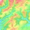
Lichtenborn topographic map

Click on the map to display elevation.

About this map

Name: Lichtenborn topographic map, elevation, terrain.

Location: Lichtenborn, Arzfeld, Eifelkreis Bitburg-Prüm, Rijnland-Palts, Duitsland (50.09100 6.26884 50.13222 6.34086)

Average elevation: 1,637 ft

Minimum elevation: 1,276 ft

Maximum elevation: 1,870 ft

Other topographic maps

Click on a map to view its topography, its elevation and its terrain.

Buscht

Duitsland > Rijnland-Palts > Eifelkreis Bitburg-Prüm

Average elevation: 1,234 ft

Gear up for your next adventure:

🔦Powerful Headlamps - Ultra-bright hands-free lighting for night navigation
📷Action Camera - Capture your outdoor adventures in HD
🔥Plasma Lighters - Windproof lighters that work in any weather condition
☕Camping Coffee Makers - Enjoy premium coffee at the summit or campsite
🛡️Bear Spray Outdoor - Protection in bear country hikes

As an Amazon Associate, this site earns from qualifying purchases at no extra cost to you.