
Weiler topographic map
Click on the map to display elevation.
About this map
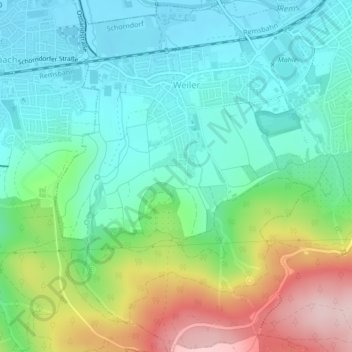
Name: Weiler topographic map, elevation, terrain.
Average elevation: 1,047 ft
Minimum elevation: 787 ft
Maximum elevation: 1,647 ft
Other topographic maps
Click on a map to view its topography, its elevation and its terrain.
Unterberken
Deutschland > Baden-Württemberg > Rems-Murr-Kreis > Schorndorf
Average elevation: 1,480 ft
Schornbach
Deutschland > Baden-Württemberg > Rems-Murr-Kreis > Schorndorf > Schornbach
Average elevation: 1,060 ft