Geolocate

Chepen topographic map

Click on the map to display elevation.

About this map

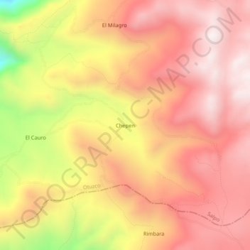
Name: Chepen topographic map, elevation, terrain.

Location: Chepen, Salpo, Province of Otuzco, La Libertad, Peru (-8.10160 -78.67129 -8.06160 -78.63129)

Average elevation: 11,421 ft

Minimum elevation: 9,603 ft

Maximum elevation: 12,365 ft

Gear up for your next adventure:

🔥Plasma Lighters - Windproof lighters that work in any weather condition
🗺️NatGeo Topo Maps - High-quality waterproof printed topographic maps of US Parks
🧤Tactile Hiking Gloves - Keep hands warm while operating GPS and smartphone screens
🏥Hiking First Aid Kits - Comprehensive medical kits for remote trail injuries
⛑️Personal Locator Beacon - Safety beacon for emergencies

As an Amazon Associate, this site earns from qualifying purchases at no extra cost to you.