
Bradfordville topographic map
Interactive map
Click on the map to display elevation.
Bradfordville
Bradfordville is an unincorporated community in northern Leon County, Florida, United States. It is 8 miles (13 km) north of Tallahassee and south of the Florida/Georgia state line by 8 miles (13 km) at the intersection of US 319 and County Road 0342 (Bannerman Road/Bradfordville Road). Its elevation is 223 feet (68 m).
About this map
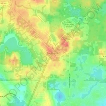
Name: Bradfordville topographic map, elevation, terrain.
Location: Bradfordville, Leon County, Florida, 32309, United States (30.54140 -84.23757 30.58140 -84.19757)
Average elevation: 167 ft
Minimum elevation: 82 ft
Maximum elevation: 256 ft
Leon County trails, hiking, mountain biking, running and outdoor activities
Other topographic maps
Click on a map to view its topography, its elevation and its terrain.