Geolocate

Atwater topographic map

Click on the map to display elevation.

About this map

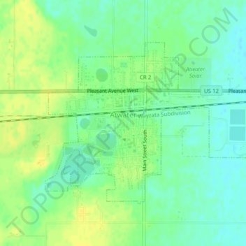
Name: Atwater topographic map, elevation, terrain.

Location: Atwater, Kandiyohi County, Minnesota, United States (45.12658 -94.79316 45.14428 -94.75719)

Average elevation: 1,220 ft

Minimum elevation: 1,188 ft

Maximum elevation: 1,257 ft

Kandiyohi County trails, hiking, mountain biking, running and outdoor activities

Other topographic maps

Click on a map to view its topography, its elevation and its terrain.

Norway Lake

United States > Minnesota > Kandiyohi County

Average elevation: 1,217 ft

Andrew Lake

United States > Minnesota > Kandiyohi County

Average elevation: 1,214 ft

Gear up for your next adventure:

🌡️Handheld Weather Meters - Measure wind, temp, and pressure for safe mountain travel
👓Polarized Sunglasses - Outdoor sunglasses for glare reduction
☀️Outdoor Sunscreen - High protection sunscreen for outdoor activities
💧Water Filtration Bottles - Safely drink from streams and lakes while exploring
🪶Camp Gear Gift Set - Perfect gift bundle for outdoor fans

As an Amazon Associate, this site earns from qualifying purchases at no extra cost to you.