
Make a donation
Gear up for your next adventure:
As an Amazon Associate, this site earns from qualifying purchases at no extra cost to you.
Ghoochan City topographic map
Click on the map to display elevation.
Make a donation
Gear up for your next adventure:
As an Amazon Associate, this site earns from qualifying purchases at no extra cost to you.
Ghoochan City
Quchan is in the north-east of Iran in Razavi Khorasan Province at an elevation of 1,149 meters above sea level north of the Shah Jahan Mountains. It is located south of the border with Turkmenistan. Quchan is connected by road to Mashhad, 125 km southeast and Turkmenistan, 100 km north.
Make a donation
Gear up for your next adventure:
As an Amazon Associate, this site earns from qualifying purchases at no extra cost to you.
About this map
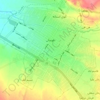
Name: Ghoochan City topographic map, elevation, terrain.
Average elevation: 4,344 ft
Minimum elevation: 4,239 ft
Maximum elevation: 4,485 ft
Make a donation
Gear up for your next adventure:
As an Amazon Associate, this site earns from qualifying purchases at no extra cost to you.