
Village of Donnelly topographic map
Interactive map
Click on the map to display elevation.
About this map
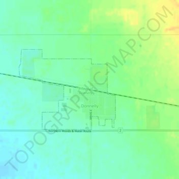
Name: Village of Donnelly topographic map, elevation, terrain.
Location: Village of Donnelly, Division No. 19, Alberta, Canada (55.72336 -117.12464 55.73545 -117.09879)
Average elevation: 1,949 ft
Minimum elevation: 1,913 ft
Maximum elevation: 2,005 ft
Other topographic maps
Click on a map to view its topography, its elevation and its terrain.
Clairmont
Canada > Alberta > Division No. 19 > Hamlet of Clairmont
Clairmont, Hamlet of Clairmont, Division No. 19, Alberta, T0H 0W0, Canada
Average elevation: 2,228 ft
Grande Prairie
Canada > Alberta > Division No. 19
Grande Prairie, Division No. 19, Alberta, Canada
Average elevation: 2,182 ft
La Glace
Canada > Alberta > Division No. 19
La Glace, Division No. 19, Alberta, T0H 2J0, Canada
Average elevation: 2,421 ft
Beaverlodge
Canada > Alberta > Division No. 19
Beaverlodge, Division No. 19, Alberta, T0H 0C0, Canada
Average elevation: 2,411 ft