
Make a donation
Gear up for your next adventure:
As an Amazon Associate, this site earns from qualifying purchases at no extra cost to you.
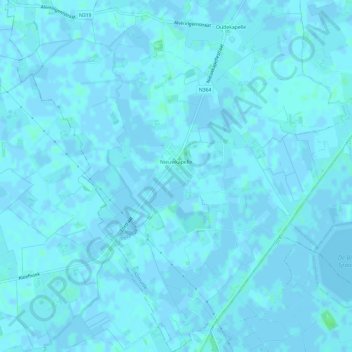
Nieuwkapelle topographic map
Click on the map to display elevation.
Make a donation
Gear up for your next adventure:
As an Amazon Associate, this site earns from qualifying purchases at no extra cost to you.
Nieuwkapelle
Nieuwkapelle ligt in het West-Vlaams poldergebied op een hoogte van ongeveer 2,5 meter. Het behoort deels tot het Oudland en deels tot het Midelland. Nabij Nieuwkapelle ligt een grote vijver, De Put genaamd. Ten oosten van Nieuwkapelle loopt de IJzer, die hier gekanaliseerd is. In het zuiden ligt Fort Knokke bij de uitmonding van de Ieperlee in de IJzer.
Make a donation
Gear up for your next adventure:
As an Amazon Associate, this site earns from qualifying purchases at no extra cost to you.
About this map
Name: Nieuwkapelle topographic map, elevation, terrain.
Location: Nieuwkapelle, Diksmuide, West-Vlaanderen, België (50.97891 2.77103 51.01632 2.82950)
Average elevation: 3 ft
Minimum elevation: -10 ft
Maximum elevation: 23 ft
Make a donation
Gear up for your next adventure:
As an Amazon Associate, this site earns from qualifying purchases at no extra cost to you.