
Thank you for supporting this site ❤️
Make a donation
Make a donation
Gear up for your next adventure:
As an Amazon Associate, this site earns from qualifying purchases at no extra cost to you.
Aftersteg topographic map
Click on the map to display elevation.
Thank you for supporting this site ❤️
Make a donation
Make a donation
Gear up for your next adventure:
As an Amazon Associate, this site earns from qualifying purchases at no extra cost to you.
About this map
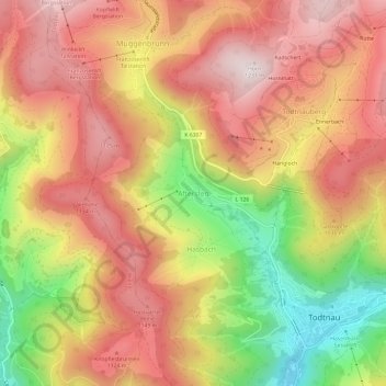
Name: Aftersteg topographic map, elevation, terrain.
Average elevation: 3,212 ft
Minimum elevation: 2,044 ft
Maximum elevation: 4,032 ft
Thank you for supporting this site ❤️
Make a donation
Make a donation
Gear up for your next adventure:
As an Amazon Associate, this site earns from qualifying purchases at no extra cost to you.
Other topographic maps
Click on a map to view its topography, its elevation and its terrain.
Todtnauberg
Deutschland > Baden-Württemberg > Landkreis Lörrach > Todtnau
Der Todtnauberger Wasserfall ist mit 97 Metern Fallhöhe in fünf Fallstufen einer der höchsten Wasserfälle Deutschlands.
Average elevation: 3,665 ft