
Cherán topographic map
Interactive map
Click on the map to display elevation.
About this map
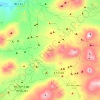
Name: Cherán topographic map, elevation, terrain.
Location: Cherán, Michoacán, Mexique (19.64504 -102.12918 19.83355 -101.87501)
Average elevation: 7,956 ft
Minimum elevation: 5,843 ft
Maximum elevation: 11,083 ft
Other topographic maps
Click on a map to view its topography, its elevation and its terrain.
Buenos Aires
Mexique > Michoacán > Lázaro Cárdenas
Buenos Aires, Lázaro Cárdenas, Michoacán, 60983, Mexique
Average elevation: 184 ft
Ciudad Hidalgo
Ciudad Hidalgo, Hidalgo, Michoacán, Mexique
Average elevation: 7,116 ft