Geolocate

Boca del Río topographic map

Click on the map to display elevation.

About this map

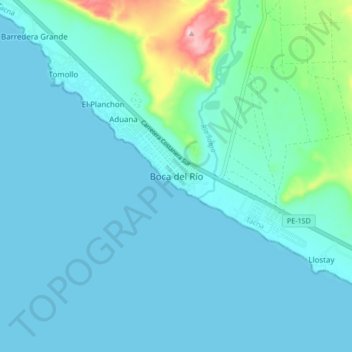
Name: Boca del Río topographic map, elevation, terrain.

Location: Boca del Río, Sama, Tacna, Perú (-18.19886 -70.71881 -18.11886 -70.63881)

Average elevation: 95 ft

Minimum elevation: 0 ft

Maximum elevation: 761 ft

Other topographic maps

Click on a map to view its topography, its elevation and its terrain.

Lomas de Morro Sama

Perú > Tacna > Sama

Average elevation: 1,043 ft

Gear up for your next adventure:

🩳Quick‑Dry Hiking Shorts - Comfortable and quick‑dry shorts for summer hiking
🗺️Topographic Maps - Detailed topo maps for hiking, exploring and outdoor navigation
🎒Hydration Pack - Hands‑free water reservoir for long hikes
🧭Map Reading Tools - Tools and kits for map navigation
🛶Inflatable Kayak - Portable kayak for rivers, lakes, and expeditions

As an Amazon Associate, this site earns from qualifying purchases at no extra cost to you.