Geolocate

Mililani topographic map

Click on the map to display elevation.

About this map

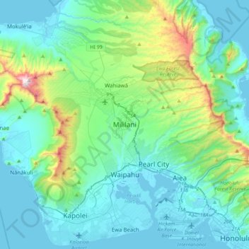
Name: Mililani topographic map, elevation, terrain.

Location: Mililani, Honolulu County, Hawaii, 96789, United States (21.29083 -158.16958 21.61083 -157.84958)

Average elevation: 676 ft

Minimum elevation: -30 ft

Maximum elevation: 4,026 ft

Gear up for your next adventure:

👓Polarized Sunglasses - Outdoor sunglasses for glare reduction
🦶Carbon Trekking Poles - Reduce knee impact on steep descents with ultra-light poles
🏫Relief Map Kits - Hands-on tools for teaching landforms and elevation
🔭Telescopic Hiking Pole - Adjustable pole for hiking stability
🌡️Portable Weather Meter - Track weather conditions on the trail

As an Amazon Associate, this site earns from qualifying purchases at no extra cost to you.