
Kosmas topographic map
Click on the map to display elevation.
Kosmas
Kosmas (Greek: Κοσμάς) is a mountain village and a former community in Arcadia, Peloponnese, Greece. It is considered a traditional settlement. Since the 2011 local government reform it is part of the municipality South Kynouria, of which it is a municipal unit. The municipal unit has an area of 85.220 km2. Kosmas is situated in the southeastern part of the Parnon mountains, at about 1150 m elevation, on the road from Skala (Laconia) to Leonidio. It is 13 km southwest of Leonidio, 28 km east of Sparti, 28 km northeast of Skala, 35 km south of Argos and 57 km southeast of Tripoli. Kosmas has a school, a church and a library.
About this map
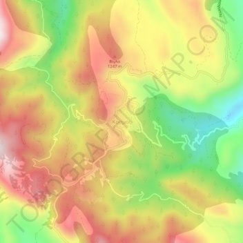
Name: Kosmas topographic map, elevation, terrain.
Average elevation: 3,599 ft
Minimum elevation: 2,589 ft
Maximum elevation: 4,475 ft