
Thank you for supporting this site ❤️
Make a donation
Make a donation
Gear up for your next adventure:
As an Amazon Associate, this site earns from qualifying purchases at no extra cost to you.
Osaka topographic map
Click on the map to display elevation.
Thank you for supporting this site ❤️
Make a donation
Make a donation
Gear up for your next adventure:
As an Amazon Associate, this site earns from qualifying purchases at no extra cost to you.
About this map
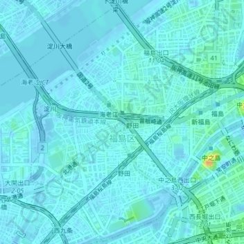
Name: Osaka topographic map, elevation, terrain.
Location: Fukushima, Osaka, Osaka Prefecture, Kinki Region, Japan (34.68061 135.46188 34.70697 135.49109)
Average elevation: 13 ft
Minimum elevation: -10 ft
Maximum elevation: 108 ft
Thank you for supporting this site ❤️
Make a donation
Make a donation
Gear up for your next adventure:
As an Amazon Associate, this site earns from qualifying purchases at no extra cost to you.