
Lake Saint-Louis topographic map
Interactive map
Click on the map to display elevation.
About this map
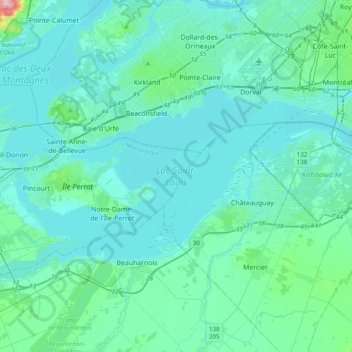
Name: Lake Saint-Louis topographic map, elevation, terrain.
Average elevation: 112 ft
Minimum elevation: 52 ft
Maximum elevation: 673 ft
Other topographic maps
Click on a map to view its topography, its elevation and its terrain.
Île Perrot
Canada > Quebec > Vaudreuil-Soulanges > Notre-Dame-de-l'Île-Perrot
Île Perrot, Notre-Dame-de-l'Île-Perrot, Vaudreuil-Soulanges, Montérégie, Quebec, Canada
Average elevation: 92 ft
Domaine du Lac
Canada > Quebec > Vaudreuil-Soulanges > Notre-Dame-de-l'Île-Perrot
Domaine du Lac, Notre-Dame-de-l'Île-Perrot, Vaudreuil-Soulanges, Montérégie, Quebec, J6N 1X8, Canada
Average elevation: 89 ft