
Make a donation
Gear up for your next adventure:
As an Amazon Associate, this site earns from qualifying purchases at no extra cost to you.
Ringen topographic map
Click on the map to display elevation.
Make a donation
Gear up for your next adventure:
As an Amazon Associate, this site earns from qualifying purchases at no extra cost to you.
Ringen
Dörfer und Schulzenämter: Cimochy (Groß Czymochen/Reuß) | Cimoszki | Gąsiorówko (Klein Gonschorowen/Kleinkiöwen) | Godziejewo (Refusowisna/Rehfeld) | Guty (Gutten) | Jelitki (Jelittken/Gelitten) | Kleszczewo (Kleschöwen/Kleschen) | Krupin (Krupinnen) | Małe Olecko (Olecko Małe) (Klein Oletzko/Herzogshöhe) | Markowskie (Markowsken/Markau) | Niedźwiedzkie (Niedzwetzken/Bärengrund) | Nory (Nordenthal/Nordental) | Nowe Raczki (Neu Retzken) | Puchówka (Puchowken/Wiesenfelde) | Rynie (Ringen) | Sobole (Sobollen/Richtenberg) | Szeszki (Seesken/Draheim) | Urbanki (Urbanken) | Wieliczki (Wielitzken/Wallenrode) | Wilkasy (Willkassen) | Wojnasy (Woynassen/Woinassen)
Make a donation
Gear up for your next adventure:
As an Amazon Associate, this site earns from qualifying purchases at no extra cost to you.
About this map
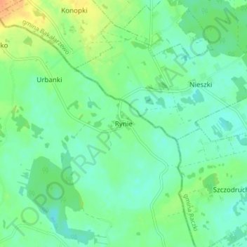
Name: Ringen topographic map, elevation, terrain.
Average elevation: 548 ft
Minimum elevation: 512 ft
Maximum elevation: 617 ft
Make a donation
Gear up for your next adventure:
As an Amazon Associate, this site earns from qualifying purchases at no extra cost to you.
Other topographic maps
Click on a map to view its topography, its elevation and its terrain.
Mummel-See
Polen > Woiwodschaft Ermland-Masuren > powiat olecki > Schwalg > Klein Sawadden
Average elevation: 469 ft