
Thank you for supporting this site ❤️
Make a donation
Make a donation
Gear up for your next adventure:
As an Amazon Associate, this site earns from qualifying purchases at no extra cost to you.
Huayllapata topographic map
Click on the map to display elevation.
Thank you for supporting this site ❤️
Make a donation
Make a donation
Gear up for your next adventure:
As an Amazon Associate, this site earns from qualifying purchases at no extra cost to you.
About this map
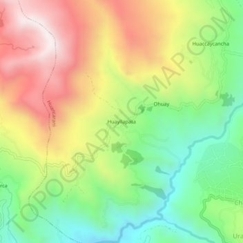
Name: Huayllapata topographic map, elevation, terrain.
Location: Huayllapata, Huancarani, Paucartambo, Cusco, Perú (-13.51380 -71.71504 -13.47380 -71.67504)
Average elevation: 12,575 ft
Minimum elevation: 11,191 ft
Maximum elevation: 14,265 ft
Thank you for supporting this site ❤️
Make a donation
Make a donation
Gear up for your next adventure:
As an Amazon Associate, this site earns from qualifying purchases at no extra cost to you.