Geolocate

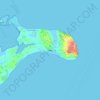
Sundby topographic map

Click on the map to display elevation.

About this map

Name: Sundby topographic map, elevation, terrain.

Location: Sundby, Guldborgsund Municipality, Region Zealand, 4800, Denmark (54.74590 11.82692 54.78590 11.86692)

Average elevation: 10 ft

Minimum elevation: -13 ft

Maximum elevation: 36 ft

Other topographic maps

Click on a map to view its topography, its elevation and its terrain.
Møn

Denmark > Region Zealand

Average elevation: 13 ft

Gear up for your next adventure:

📡GPS Antenna Upgrade - Enhance GPS reception in remote terrain
🏕️Family Camping Gear - Essentials for group camping trips
🔋Rechargeable Batteries - Power up your outdoor devices
🛠️Outdoor Gear Repair Kit - Essential tools to fix gear on the trail
🪶Trail Camera - Capture wildlife on your hikes

As an Amazon Associate, this site earns from qualifying purchases at no extra cost to you.