
Thank you for supporting this site ❤️
Make a donation
Make a donation
Gear up for your next adventure:
As an Amazon Associate, this site earns from qualifying purchases at no extra cost to you.
Maltondi topographic map
Click on the map to display elevation.
Thank you for supporting this site ❤️
Make a donation
Make a donation
Gear up for your next adventure:
As an Amazon Associate, this site earns from qualifying purchases at no extra cost to you.
About this map
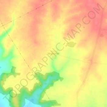
Name: Maltondi topographic map, elevation, terrain.
Location: Maltondi, Mantha, Jalna, Maharashtra, 431504, India (19.70938 76.38075 19.74938 76.42075)
Average elevation: 1,693 ft
Minimum elevation: 1,539 ft
Maximum elevation: 1,768 ft
Thank you for supporting this site ❤️
Make a donation
Make a donation
Gear up for your next adventure:
As an Amazon Associate, this site earns from qualifying purchases at no extra cost to you.