
Water Valley topographic map
Interactive map
Click on the map to display elevation.
About this map
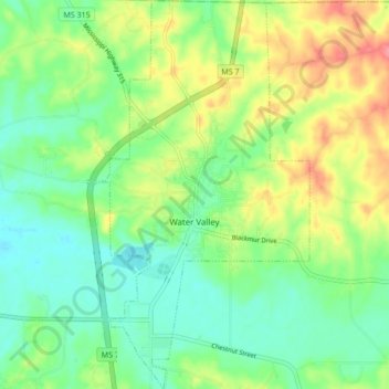
Name: Water Valley topographic map, elevation, terrain.
Location: Water Valley, Yalobusha County, Mississippi, United States (34.12119 -89.65232 34.19156 -89.60626)
Average elevation: 344 ft
Minimum elevation: 246 ft
Maximum elevation: 512 ft
Other topographic maps
Click on a map to view its topography, its elevation and its terrain.
Hubbard Creek
United States > Mississippi > Yalobusha County
Hubbard Creek, Yalobusha County, Mississippi, 38658, United States
Average elevation: 262 ft
Coffeeville
United States > Mississippi > Yalobusha County
Coffeeville, Yalobusha County, Mississippi, United States
Average elevation: 259 ft