
Thank you for supporting this site ❤️
Make a donation
Make a donation
Gear up for your next adventure:
As an Amazon Associate, this site earns from qualifying purchases at no extra cost to you.
Salaioli topographic map
Click on the map to display elevation.
Thank you for supporting this site ❤️
Make a donation
Make a donation
Gear up for your next adventure:
As an Amazon Associate, this site earns from qualifying purchases at no extra cost to you.
About this map
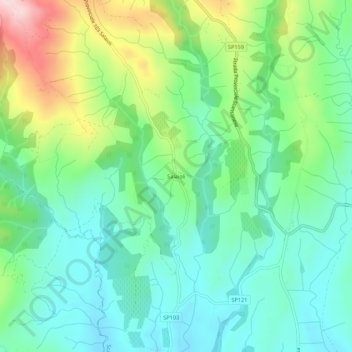
Name: Salaioli topographic map, elevation, terrain.
Location: Salaioli, Scansano, Grosseto, Toscana, Italia (42.63054 11.34865 42.67054 11.38865)
Average elevation: 679 ft
Minimum elevation: 348 ft
Maximum elevation: 1,460 ft
Thank you for supporting this site ❤️
Make a donation
Make a donation
Gear up for your next adventure:
As an Amazon Associate, this site earns from qualifying purchases at no extra cost to you.