
Thank you for supporting this site ❤️
Make a donation
Make a donation
Gear up for your next adventure:
As an Amazon Associate, this site earns from qualifying purchases at no extra cost to you.
Matagalls topographic map
Click on the map to display elevation.
Thank you for supporting this site ❤️
Make a donation
Make a donation
Gear up for your next adventure:
As an Amazon Associate, this site earns from qualifying purchases at no extra cost to you.
About this map
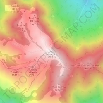
Name: Matagalls topographic map, elevation, terrain.
Location: Matagalls, Viladrau, Osona, Gerona, Cataluña, 17406, España (41.80875 2.38267 41.80885 2.38277)
Average elevation: 4,573 ft
Minimum elevation: 3,035 ft
Maximum elevation: 5,531 ft
Thank you for supporting this site ❤️
Make a donation
Make a donation
Gear up for your next adventure:
As an Amazon Associate, this site earns from qualifying purchases at no extra cost to you.