
Thank you for supporting this site ❤️
Make a donation
Make a donation
Gear up for your next adventure:
As an Amazon Associate, this site earns from qualifying purchases at no extra cost to you.
Helchteren topographic map
Click on the map to display elevation.
Thank you for supporting this site ❤️
Make a donation
Make a donation
Gear up for your next adventure:
As an Amazon Associate, this site earns from qualifying purchases at no extra cost to you.
About this map
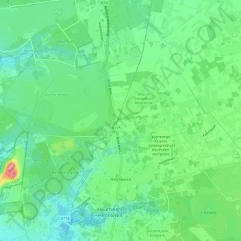
Name: Helchteren topographic map, elevation, terrain.
Location: Helchteren, Houthalen-Helchteren, Maaseik, Limbourg, Belgique (51.04455 5.33937 51.10402 5.45441)
Average elevation: 223 ft
Minimum elevation: 135 ft
Maximum elevation: 466 ft
Thank you for supporting this site ❤️
Make a donation
Make a donation
Gear up for your next adventure:
As an Amazon Associate, this site earns from qualifying purchases at no extra cost to you.