
Make a donation
Gear up for your next adventure:
As an Amazon Associate, this site earns from qualifying purchases at no extra cost to you.
Ngoura topographic map
Click on the map to display elevation.
Make a donation
Gear up for your next adventure:
As an Amazon Associate, this site earns from qualifying purchases at no extra cost to you.
About this map
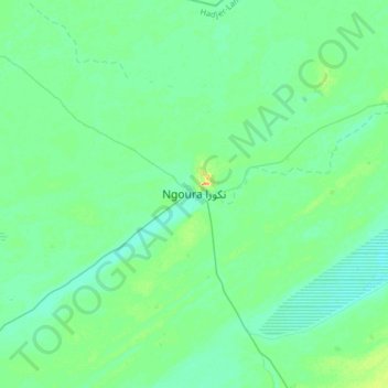
Name: Ngoura topographic map, elevation, terrain.
Location: Ngoura, Hadjer-Lamis, Chad (12.71863 16.28972 13.03863 16.60972)
Average elevation: 951 ft
Minimum elevation: 928 ft
Maximum elevation: 1,030 ft
Make a donation
Gear up for your next adventure:
As an Amazon Associate, this site earns from qualifying purchases at no extra cost to you.
Other topographic maps
Click on a map to view its topography, its elevation and its terrain.
Lake Chad
Lake Chad is divided into north and south parts by a shallow sill called the Great Barrier, with the bottom of the northern basin at an altitude of 275.3 m (903 ft) and the bottom of the southern basin at 278.2 m (913 ft). When the water level in the south exceeds 279 m (915 ft) above sea level, it will flow…
Average elevation: 925 ft
Lake Chad
Lake Chad has shrunk considerably since the 1960s, when its shoreline had an elevation of about 286 metres (938 ft) above sea level and it had an area of more than 26,000 square kilometres (10,000 sq mi), making its surface the fourth largest in Africa. An increased demand on the lake's water from the local…
Average elevation: 925 ft