
Make a donation
Gear up for your next adventure:
As an Amazon Associate, this site earns from qualifying purchases at no extra cost to you.
Grove City topographic map
Click on the map to display elevation.
Make a donation
Gear up for your next adventure:
As an Amazon Associate, this site earns from qualifying purchases at no extra cost to you.
About this map
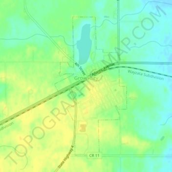
Name: Grove City topographic map, elevation, terrain.
Location: Grove City, Meeker County, Minnesota, 56243, United States (45.13830 -94.69015 45.16009 -94.67403)
Average elevation: 1,198 ft
Minimum elevation: 1,158 ft
Maximum elevation: 1,230 ft
Meeker County trails, hiking, mountain biking, running and outdoor activities
Make a donation
Gear up for your next adventure:
As an Amazon Associate, this site earns from qualifying purchases at no extra cost to you.
Other topographic maps
Click on a map to view its topography, its elevation and its terrain.
Spencer Lake
United States > Minnesota > Meeker County > Collinwood Township > Jennie
Average elevation: 1,096 ft