
Morro El Gallo topographic map
Interactive map
Click on the map to display elevation.
About this map
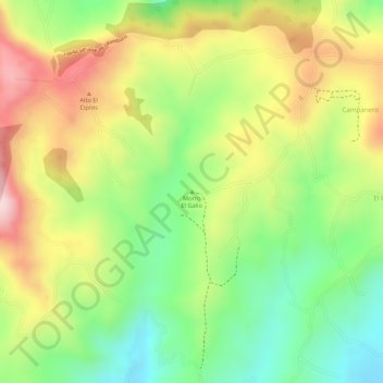
Name: Morro El Gallo topographic map, elevation, terrain.
Location: Morro El Gallo, Pasto, Centro, Nariño, 0057, Colombia (1.13508 -77.27592 1.13518 -77.27582)
Average elevation: 10,279 ft
Minimum elevation: 9,823 ft
Maximum elevation: 10,758 ft
Other topographic maps
Click on a map to view its topography, its elevation and its terrain.