Geolocate

Palsana topographic map

Click on the map to display elevation.

About this map

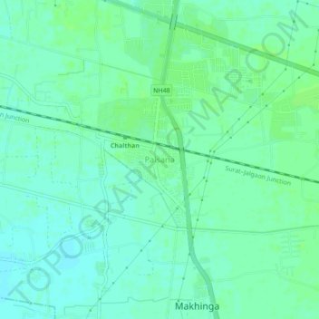
Name: Palsana topographic map, elevation, terrain.

Location: Palsana, Palsana Taluka, Surat, Gujarat, 394315, India (21.13456 72.94099 21.17456 72.98099)

Average elevation: 72 ft

Minimum elevation: 56 ft

Maximum elevation: 82 ft

Gear up for your next adventure:

💧Water Purification System - Clean water on the trail with reliable purifiers
🧣Merino Neck Gaiters - Multi-functional headwear for wind and sun protection
🧥Waterproof Jacket for Hiking - Breathable and rugged rain jacket for outdoor excursions
☀️Outdoor Sunscreen - High protection sunscreen for outdoor activities
🦶Carbon Trekking Poles - Reduce knee impact on steep descents with ultra-light poles

As an Amazon Associate, this site earns from qualifying purchases at no extra cost to you.