
Make a donation
Gear up for your next adventure:
As an Amazon Associate, this site earns from qualifying purchases at no extra cost to you.
Ossendorf topographic map
Click on the map to display elevation.
Make a donation
Gear up for your next adventure:
As an Amazon Associate, this site earns from qualifying purchases at no extra cost to you.
About this map
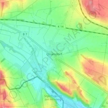
Name: Ossendorf topographic map, elevation, terrain.
Average elevation: 656 ft
Minimum elevation: 548 ft
Maximum elevation: 853 ft
Make a donation
Gear up for your next adventure:
As an Amazon Associate, this site earns from qualifying purchases at no extra cost to you.
Other topographic maps
Click on a map to view its topography, its elevation and its terrain.
Scherfede
Deutschland > Nordrhein-Westfalen > Kreis Höxter > Warburg > Hardehausen
Average elevation: 984 ft
Welda
Deutschland > Nordrhein-Westfalen > Kreis Höxter > Warburg > Welda
Die Gemarkung Welda befindet sich größtenteils im Tal der oberen Twiste, in die im Dorf der von Westen, aus dem benachbarten hessischen Hörle kommende Hörler Bach einmündet. In Hessen wird der in der Nähe von Dehausen entspringende „Hörler Bach“ offiziell gleichnamig Welda genannt. Die Gemarkung ist…
Average elevation: 722 ft
Hohenwepel
Deutschland > Nordrhein-Westfalen > Kreis Höxter > Warburg > Hohenwepel
Average elevation: 722 ft
Make a donation
Gear up for your next adventure:
As an Amazon Associate, this site earns from qualifying purchases at no extra cost to you.