Geolocate

Jiribam topographic map

Click on the map to display elevation.

About this map

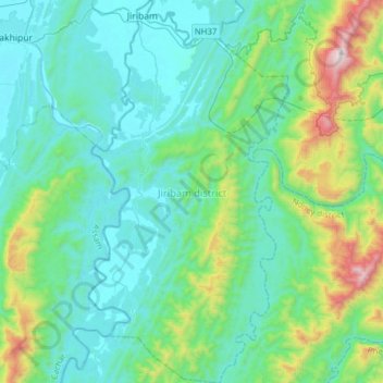
Name: Jiribam topographic map, elevation, terrain.

Location: Jiribam, Manipur, 795116, India (24.53641 93.07059 24.81953 93.23350)

Average elevation: 820 ft

Minimum elevation: 33 ft

Maximum elevation: 4,377 ft

Gear up for your next adventure:

🪶Multi‑Purpose Knife - Useful blade for camp and trail
👟Trail Running Shoes - Lightweight shoes for trail runners
🥇GPS Hiking Watch - Multi‑sport GPS watch with navigation and trail tracking
🪶Paracord Bracelet - Survival bracelet with built‑in tools
🧭Compass with Lanyard - Easy‑carry compass for navigation

As an Amazon Associate, this site earns from qualifying purchases at no extra cost to you.