Geolocate

Akure topographic map

Click on the map to display elevation.

About this map

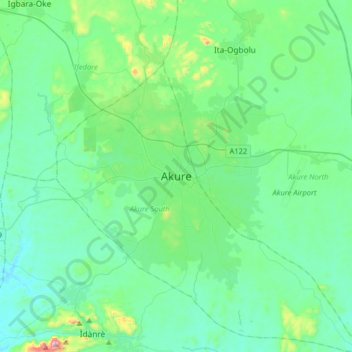
Name: Akure topographic map, elevation, terrain.

Location: Akure, Akure South, Ondo State, 340021, Nigeria (7.09256 5.03326 7.41256 5.35326)

Average elevation: 1,093 ft

Minimum elevation: 705 ft

Maximum elevation: 3,081 ft

Gear up for your next adventure:

🗃️Trail First Aid Kit - Essential kit for outdoor injuries and emergencies
🗺️NatGeo Topo Maps - High-quality waterproof printed topographic maps of US Parks
🧣Merino Neck Gaiters - Multi-functional headwear for wind and sun protection
🥘Titanium Cookware - Durable, featherlight pots and pans for backpacking
🌲Outdoor Survival Books - Best books on survival skills

As an Amazon Associate, this site earns from qualifying purchases at no extra cost to you.