
Thank you for supporting this site ❤️
Make a donation
Make a donation
Gear up for your next adventure:
As an Amazon Associate, this site earns from qualifying purchases at no extra cost to you.
Huaytapallana topographic map
Click on the map to display elevation.
Thank you for supporting this site ❤️
Make a donation
Make a donation
Gear up for your next adventure:
As an Amazon Associate, this site earns from qualifying purchases at no extra cost to you.
About this map
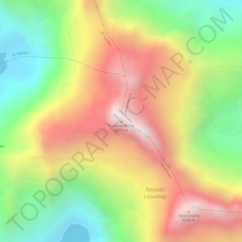
Name: Huaytapallana topographic map, elevation, terrain.
Location: Huaytapallana, Huancayo, Junín, Peru (-11.90856 -75.05407 -11.90846 -75.05397)
Average elevation: 16,693 ft
Minimum elevation: 15,213 ft
Maximum elevation: 18,127 ft
Thank you for supporting this site ❤️
Make a donation
Make a donation
Gear up for your next adventure:
As an Amazon Associate, this site earns from qualifying purchases at no extra cost to you.