
Thank you for supporting this site ❤️
Make a donation
Make a donation
Gear up for your next adventure:
As an Amazon Associate, this site earns from qualifying purchases at no extra cost to you.
Udhailiyah topographic map
Click on the map to display elevation.
Thank you for supporting this site ❤️
Make a donation
Make a donation
Gear up for your next adventure:
As an Amazon Associate, this site earns from qualifying purchases at no extra cost to you.
About this map
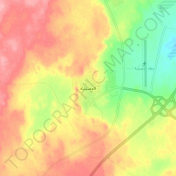
Name: Udhailiyah topographic map, elevation, terrain.
Location: Udhailiyah, Al Ahsa Governorate, Eastern Region, Saudi Arabia (25.10048 49.25990 25.18048 49.33990)
Average elevation: 902 ft
Minimum elevation: 699 ft
Maximum elevation: 1,063 ft
Thank you for supporting this site ❤️
Make a donation
Make a donation
Gear up for your next adventure:
As an Amazon Associate, this site earns from qualifying purchases at no extra cost to you.