Geolocate

Tama topographic map

Click on the map to display elevation.

About this map

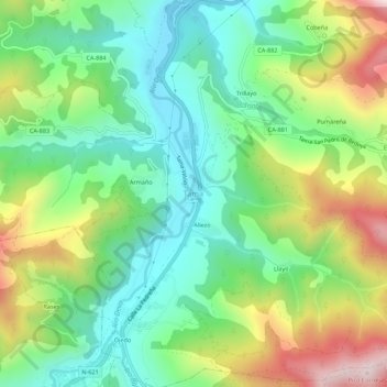
Name: Tama topographic map, elevation, terrain.

Location: Tama, Cillorigo de Liébana, Cantabria, 39584, Spain (43.15608 -4.62108 43.19608 -4.58108)

Average elevation: 1,499 ft

Minimum elevation: 751 ft

Maximum elevation: 2,881 ft

Gear up for your next adventure:

📱Heavy-Duty Phone Cases - Drop-proof and waterproof protection for outdoor navigation
🛠️Outdoor Gear Repair Kit - Essential tools to fix gear on the trail
🔌Solar Panel Charger - Charge gear sustainably outdoors
🗻Climbing Gear Basics - Essential gear for beginner climbers
📌Outdoor GPS Map App - Apps and devices for digital topographic navigation

As an Amazon Associate, this site earns from qualifying purchases at no extra cost to you.