Geolocate

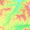
Terelj topographic map

Click on the map to display elevation.

About this map

Name: Terelj topographic map, elevation, terrain.

Location: Terelj, Ulaanbaatar, Mongolia (47.97222 107.43538 48.01222 107.47538)

Average elevation: 5,262 ft

Minimum elevation: 4,948 ft

Maximum elevation: 6,253 ft

Other topographic maps

Click on a map to view its topography, its elevation and its terrain.

Songino Khairkhan

Mongolia > Ulaanbaatar

Average elevation: 4,783 ft

Nalaikh

Mongolia > Ulaanbaatar

Average elevation: 5,249 ft

Khan-Uul

Mongolia > Ulaanbaatar

Average elevation: 4,619 ft

River

Mongolia > Ulaanbaatar

Average elevation: 4,734 ft

talbai

Mongolia > Ulaanbaatar

Average elevation: 4,452 ft

Baganuur

Mongolia > Ulaanbaatar

Average elevation: 4,741 ft

Gear up for your next adventure:

🔋Rechargeable Batteries - Power up your outdoor devices
🧷Carabiner Set - Durable clips for gear attachment
🗺️NatGeo Topo Maps - High-quality waterproof printed topographic maps of US Parks
🧭GPS Watch Accessories - Bands and chargers for GPS watches
🥤Water Filter Bottle - All‑in‑one filter bottle for safe hydration

As an Amazon Associate, this site earns from qualifying purchases at no extra cost to you.