Make a donation
Gear up for your next adventure:
As an Amazon Associate, this site earns from qualifying purchases at no extra cost to you.
Gomoh topographic map
Click on the map to display elevation.
Make a donation
Gear up for your next adventure:
As an Amazon Associate, this site earns from qualifying purchases at no extra cost to you.
Gomoh
Gomoh is located at 23°52′N 86°10′E / 23.87°N 86.17°E / 23.87; 86.17. It has an average elevation of 245 metres (803 feet). The town has an area of 8.96 km2. It is 37 km from the district administrative headquarters in Dhanbad.
Make a donation
Gear up for your next adventure:
As an Amazon Associate, this site earns from qualifying purchases at no extra cost to you.
About this map
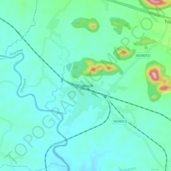
Name: Gomoh topographic map, elevation, terrain.
Location: Gomoh, Topchanchi, Dhanbad, Jharkhand, 828401, India (23.83353 86.11159 23.91353 86.19159)
Average elevation: 814 ft
Minimum elevation: 663 ft
Maximum elevation: 1,598 ft
Make a donation
Gear up for your next adventure:
As an Amazon Associate, this site earns from qualifying purchases at no extra cost to you.
