
Kadayanallur topographic map
Click on the map to display elevation.
Kadayanallur
Kadayanallur is at 9°05′N 77°21′E / 9.08°N 77.35°E / 9.08; 77.35. The town is on the foot of the Western Ghat and has an average elevation of 191 m (627 ft).The town is surrounded by the western ghats in three sides and is situated on the way from Madurai to Kollam highway
About this map
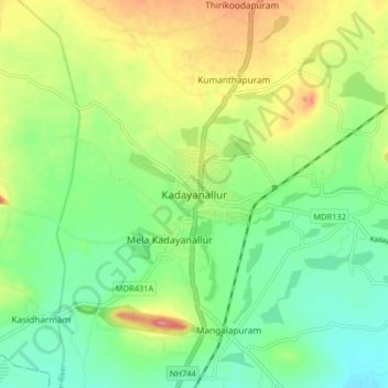
Name: Kadayanallur topographic map, elevation, terrain.
Location: Kadayanallur, Tenkasi, Tamil Nadu, 627751, India (9.04420 77.30620 9.12420 77.38620)
Average elevation: 646 ft
Minimum elevation: 538 ft
Maximum elevation: 814 ft