Geolocate

Calera topographic map

Click on the map to display elevation.

About this map

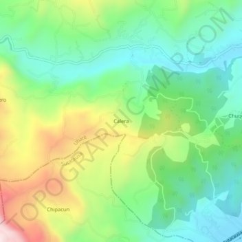
Name: Calera topographic map, elevation, terrain.

Location: Calera, Ubaté, Cundinamarca, Colombia (5.27366 -73.87020 5.31366 -73.83020)

Average elevation: 9,101 ft

Minimum elevation: 8,402 ft

Maximum elevation: 10,404 ft

Gear up for your next adventure:

📷Action Camera - Capture your outdoor adventures in HD
🍳Camping Cook Set - Complete cookware for outdoor meals
🦺Reflective Outdoor Gear - Safety gear for low‑light conditions
🌡️Handheld Weather Meters - Measure wind, temp, and pressure for safe mountain travel
🔌Solar Panel Charger - Charge gear sustainably outdoors

As an Amazon Associate, this site earns from qualifying purchases at no extra cost to you.