
บ้านวังนกแอ่น topographic map
Interactive map
Click on the map to display elevation.
About this map
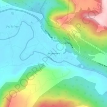
Name: บ้านวังนกแอ่น topographic map, elevation, terrain.
Location: บ้านวังนกแอ่น, Phitsanulok, Thaïlande (16.82962 100.48827 16.86962 100.52827)
Average elevation: 417 ft
Minimum elevation: 154 ft
Maximum elevation: 1,060 ft
Other topographic maps
Click on a map to view its topography, its elevation and its terrain.
บ้านคลอง
Thaïlande > Phitsanulok > บึงพระ
บ้านคลอง, อรัญญิก, บึงพระ, Phitsanulok, 65000, Thaïlande
Average elevation: 148 ft