
บ้านกกม่วง topographic map
Interactive map
Click on the map to display elevation.
About this map
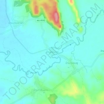
Name: บ้านกกม่วง topographic map, elevation, terrain.
Location: บ้านกกม่วง, Phitsanulok, Thaïlande (17.12782 100.90829 17.16782 100.94829)
Average elevation: 758 ft
Minimum elevation: 686 ft
Maximum elevation: 1,053 ft
Other topographic maps
Click on a map to view its topography, its elevation and its terrain.
บ้านคลอง
Thaïlande > Phitsanulok > บึงพระ
บ้านคลอง, อรัญญิก, บึงพระ, Phitsanulok, 65000, Thaïlande
Average elevation: 148 ft