Geolocate

Sutton topographic map

Click on the map to display elevation.

About this map

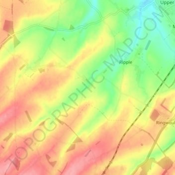
Name: Sutton topographic map, elevation, terrain.

Location: Sutton, Dover, Kent, South East England, England, United Kingdom (51.16995 1.28700 51.21714 1.35669)

Average elevation: 174 ft

Minimum elevation: 13 ft

Maximum elevation: 308 ft

Gear up for your next adventure:

🌡️Portable Weather Meter - Track weather conditions on the trail
🌐World Map Poster - Decorative world maps with topographic info
🪶Camp Gear Gift Set - Perfect gift bundle for outdoor fans
🛌Ultralight Sleeping Bags - Compact down bags for cold nights in the wilderness
😴Insulated Sleeping Pads - Compact and warm pads for high-elevation camping

As an Amazon Associate, this site earns from qualifying purchases at no extra cost to you.