
Thank you for supporting this site ❤️
Make a donation
Make a donation
Gear up for your next adventure:
As an Amazon Associate, this site earns from qualifying purchases at no extra cost to you.
Guajaraz topographic map
Click on the map to display elevation.
Thank you for supporting this site ❤️
Make a donation
Make a donation
Gear up for your next adventure:
As an Amazon Associate, this site earns from qualifying purchases at no extra cost to you.
About this map
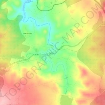
Name: Guajaraz topographic map, elevation, terrain.
Location: Guajaraz, Argés, Toledo, Castilla-La Mancha, 45122, España (39.79624 -4.11390 39.83624 -4.07390)
Average elevation: 1,985 ft
Minimum elevation: 1,716 ft
Maximum elevation: 2,228 ft
Thank you for supporting this site ❤️
Make a donation
Make a donation
Gear up for your next adventure:
As an Amazon Associate, this site earns from qualifying purchases at no extra cost to you.