
Thank you for supporting this site ❤️
Make a donation
Make a donation
Gear up for your next adventure:
As an Amazon Associate, this site earns from qualifying purchases at no extra cost to you.
Marroggia topographic map
Click on the map to display elevation.
Thank you for supporting this site ❤️
Make a donation
Make a donation
Gear up for your next adventure:
As an Amazon Associate, this site earns from qualifying purchases at no extra cost to you.
About this map
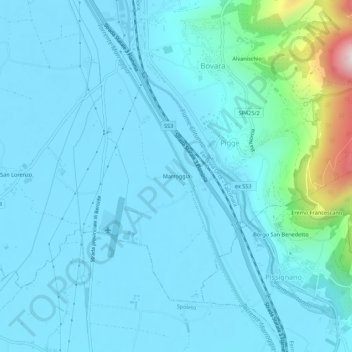
Name: Marroggia topographic map, elevation, terrain.
Location: Marroggia, Pigge, Trevi, Perugia, Umbria, 06039, Italy (42.82841 12.72377 42.86841 12.76377)
Average elevation: 902 ft
Minimum elevation: 689 ft
Maximum elevation: 2,612 ft
Thank you for supporting this site ❤️
Make a donation
Make a donation
Gear up for your next adventure:
As an Amazon Associate, this site earns from qualifying purchases at no extra cost to you.