Geolocate

Floyd topographic map

Click on the map to display elevation.

About this map

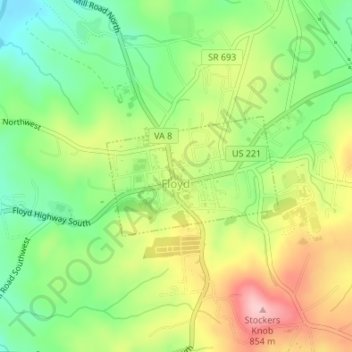
Name: Floyd topographic map, elevation, terrain.

Location: Floyd, Floyd County, Virginia, United States (36.90719 -80.32669 36.91639 -80.31016)

Average elevation: 2,444 ft

Minimum elevation: 2,178 ft

Maximum elevation: 2,789 ft

Floyd County trails, hiking, mountain biking, running and outdoor activities

Gear up for your next adventure:

🎒Gear Packing Cubes - Organize your backpack efficiently
🪶Camping Sleeping Pad - Comfortable sleeping pad for backpacking
🛡️Bear Spray Outdoor - Protection in bear country hikes
🧥Men's Rain Shells - Premium waterproof and breathable jackets for mountain weather
🧣Merino Neck Gaiters - Multi-functional headwear for wind and sun protection

As an Amazon Associate, this site earns from qualifying purchases at no extra cost to you.