Geolocate

Rabba topographic map

Click on the map to display elevation.

About this map

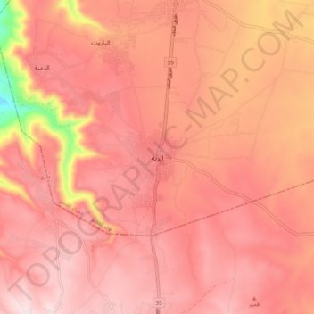
Name: Rabba topographic map, elevation, terrain.

Location: Rabba, Qasr Sub-District, Qasr District, Karak, 61210, Jordan (31.22922 35.69777 31.30922 35.77777)

Average elevation: 3,054 ft

Minimum elevation: 1,857 ft

Maximum elevation: 3,488 ft

Gear up for your next adventure:

🏕️Tent Footprint - Protect your tent base from wear
🔥Plasma Lighters - Windproof lighters that work in any weather condition
🪑Ultralight Camp Chairs - Portable seating for resting after a long day of mapping
🧯Emergency Survival Kit - All‑in‑one survival essentials for the backcountry
🦺Reflective Outdoor Gear - Safety gear for low‑light conditions

As an Amazon Associate, this site earns from qualifying purchases at no extra cost to you.