Geolocate

Sri Gading topographic map

Click on the map to display elevation.

About this map

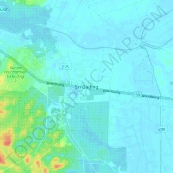
Name: Sri Gading topographic map, elevation, terrain.

Location: Sri Gading, Batu Pahat, Johor, 83300, Malaysia (1.81416 102.99044 1.89416 103.07044)

Average elevation: 26 ft

Minimum elevation: 3 ft

Maximum elevation: 194 ft

Gear up for your next adventure:

🪶Paracord Bracelet - Survival bracelet with built‑in tools
🎒Outdoor Daypacks - Lightweight backpacks designed for carrying maps and essential gear
Backpacking Tents - Weight-optimized shelters for multi-day topographic surveys
🪓Survival Multi‑Tool - Versatile tool for camp and trail tasks
🪶Camping Sleeping Pad - Comfortable sleeping pad for backpacking

As an Amazon Associate, this site earns from qualifying purchases at no extra cost to you.