Geolocate

Foro topographic map

Click on the map to display elevation.

About this map

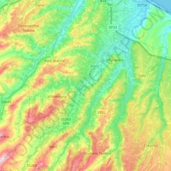
Name: Foro topographic map, elevation, terrain.

Location: Foro, Miglianico, Chieti, Abruzzo, 66010, Italy (42.28012 14.20368 42.40141 14.32750)

Average elevation: 469 ft

Minimum elevation: -7 ft

Maximum elevation: 1,250 ft

Gear up for your next adventure:

📡Handheld GPS Device - Reliable handheld GPS for outdoor navigation
💧Water Purification System - Clean water on the trail with reliable purifiers
🍳Camping Cook Set - Complete cookware for outdoor meals
🪶Wildlife Field Guides - Learn animal tracking and species ID
📚USA Hiking Guide Books - Top trail guides and map books

As an Amazon Associate, this site earns from qualifying purchases at no extra cost to you.