Geolocate

Kotputli topographic map

Click on the map to display elevation.

Kotputli

Kotputli has an average elevation of 439 meters (1,440 ft).

Wikipedia (CC-BY-SA 3.0)

About this map

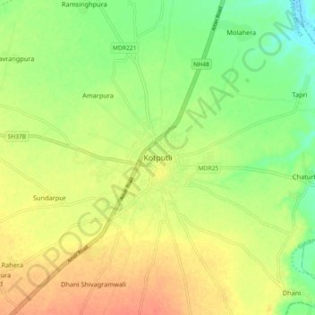
Name: Kotputli topographic map, elevation, terrain.

Location: Kotputli, Kotpuli Tehsil, Kotputli-Behror, Rajasthan, 303108, India (27.66717 76.15964 27.74717 76.23964)

Average elevation: 1,161 ft

Minimum elevation: 1,089 ft

Maximum elevation: 1,227 ft

Gear up for your next adventure:

🏥Hiking First Aid Kits - Comprehensive medical kits for remote trail injuries
🗻Climbing Gear Basics - Essential gear for beginner climbers
🦺Reflective Outdoor Gear - Safety gear for low‑light conditions
🦶Carbon Trekking Poles - Reduce knee impact on steep descents with ultra-light poles
🏫Relief Map Kits - Hands-on tools for teaching landforms and elevation

As an Amazon Associate, this site earns from qualifying purchases at no extra cost to you.