
Thank you for supporting this site ❤️
Make a donation
Make a donation
Gear up for your next adventure:
As an Amazon Associate, this site earns from qualifying purchases at no extra cost to you.
Shencottai topographic map
Click on the map to display elevation.
Thank you for supporting this site ❤️
Make a donation
Make a donation
Gear up for your next adventure:
As an Amazon Associate, this site earns from qualifying purchases at no extra cost to you.
About this map
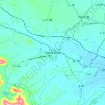
Name: Shencottai topographic map, elevation, terrain.
Location: Shencottai, Shenkottai, Tenkasi, Tamil Nadu, 627809, India (8.93466 77.21073 9.01466 77.29073)
Average elevation: 617 ft
Minimum elevation: 492 ft
Maximum elevation: 1,516 ft
Thank you for supporting this site ❤️
Make a donation
Make a donation
Gear up for your next adventure:
As an Amazon Associate, this site earns from qualifying purchases at no extra cost to you.