
Holiday Poconos topographic map
Click on the map to display elevation.
About this map
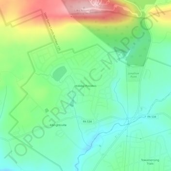
Name: Holiday Poconos topographic map, elevation, terrain.
Average elevation: 1,703 ft
Minimum elevation: 1,470 ft
Maximum elevation: 2,175 ft
Carbon County trails, hiking, mountain biking, running and outdoor activities
Other topographic maps
Click on a map to view its topography, its elevation and its terrain.
Lake Harmony
United States > Pennsylvania > Carbon County > Kidder Township > Lake Harmony
Average elevation: 1,864 ft
Hickory Run State Park
United States > Pennsylvania > Carbon County > Kidder Township
Average elevation: 1,545 ft