
Longwood topographic map
Click on the map to display elevation.
About this map
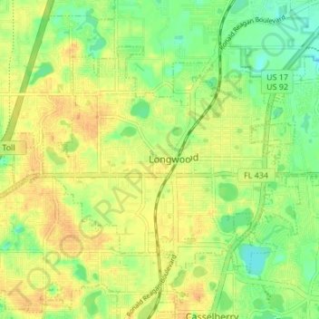
Name: Longwood topographic map, elevation, terrain.
Location: Longwood, Seminole County, Florida, 32750, United States (28.67962 -81.39162 28.72184 -81.32390)
Average elevation: 79 ft
Minimum elevation: 23 ft
Maximum elevation: 121 ft
Seminole County trails, hiking, mountain biking, running and outdoor activities
Other topographic maps
Click on a map to view its topography, its elevation and its terrain.
Econ River Wilderness Area
United States > Florida > Seminole County > Oviedo
Average elevation: 49 ft
Sanlando Springs
United States > Florida > Seminole County > Sanlando Springs
Average elevation: 82 ft